Show more than words: lat/long, British National Grid, and a secondary language on web and in the app


Many teams work with coordinates because that’s how their forms, templates and tools are set up. With what3words you can keep the human-friendly 3 word address as your anchor, and then add other location formats, providing more context when needed. Every what3words address points to a precise 3 metre square, so you always start from something short and easy to read, type and remember.
This guide shows how to surface latitude and longitude, British National Grid, and a secondary language alongside a what3words address, on both the what3words map site and the mobile apps.
Map site – show several items at once
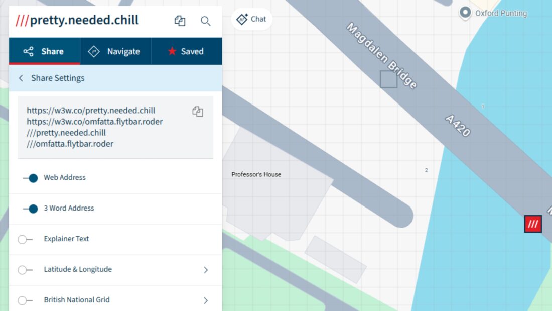
On the web map, open Share for any square. The panel stays open while you click around, so it works like the app’s “display settings” feature, but on desktop. You can turn on any combination of:
- Web link – a short URL for the square
- 3 word address – the main label
- Latitude & Longitude – choose the format you prefer
- British National Grid – choose Eastings and Northings, a grid reference, or both (Note: This feature is only available to those accessing the online map from the UK)
- Share in another language – show the same square in a second language, for example, English and Swedish
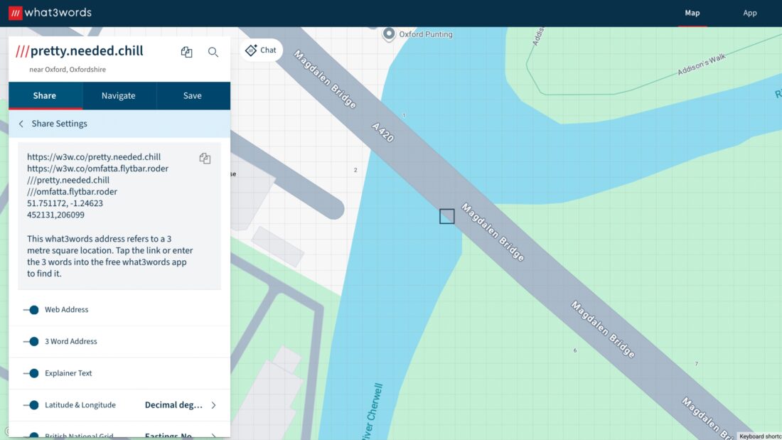
Tip: reverse coordinate order: If you work in GIS or export to GeoJSON, you may think in X, Y rather than Y, X. The “reverse coordinate order” toggle switches to longitude, latitude to match that convention if you prefer it.
Apps – pick one additional format to display, include several when you share
On iOS and Android the same options are available, with a small difference in how they appear.
-
Display settings
show while you move around the map. Choose one of Latitude & Longitude (pick a format), British National Grid, or Secondary Language.
-
Share settings
appear when you tap Share. Here you can bundle multiple items, similar to the map site.
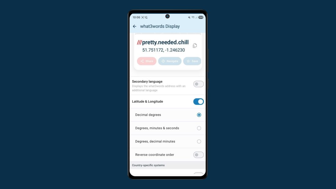
Latitude and longitude – three formats you can show
Latitude and longitude are available in three common styles. Pick the one your team expects:
- Decimal degrees – widely used in web mapping, spreadsheets and APIs.
-
Degrees, minutes & seconds
– the traditional cartographic format found in many technical documents.
-
Degrees & decimal minutes
– commonly requested in flight planning and helicopter operations.
Tip: GIS workflows often use lon, lat input. Use the “reverse coordinates order” toggle before you copy or share. For example, the GeoJSON standard uses longitude, latitude.
A quick note on reference frames: In the UK, lat/long uses WGS84, but British National Grid uses OSGB36 on a Transverse Mercator projection. Numeric coordinates for the same point won’t match exactly – that’s documented by Ordnance Survey.
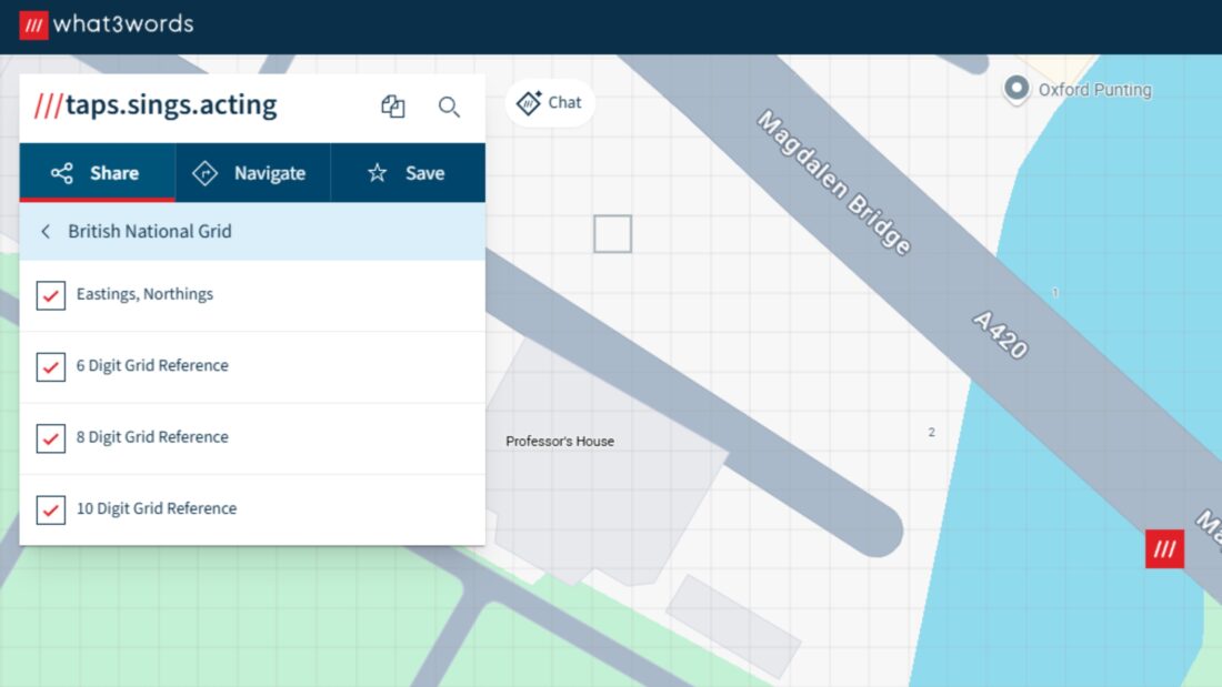
British National Grid – options and when they are useful
If you work in the UK, you can add British National Grid (BNG) to your what3words display or share content. Many construction, utilities, surveying and monitoring teams rely on BNG in their work.
You can choose:
-
Eastings & Northings
– metre‑based coordinates in OSGB36.
-
Grid references
– two letters for the 100 km square, followed by 6, 8, or 10 digits for increasing precision:
-
6‑digit grid reference pinpoints a ~100 m square.
- 8‑digit grid reference pinpoints a ~10 m square.
- 10‑digit grid reference pinpoints a ~1 m square.
Secondary language – the same square, another language
If you live or work bilingually, you can display or share the same square in a second language—handy for cross-border projects, bilingual teams, and expats . On the map site, add a second language in the Share panel. In the apps, select Secondary language in Display settings, or add it in Share settings.
Share workflows that save time
Because what3words stays readable, you can share a compact bundle that travels easily between tools:
-
what3words + Decimal degrees
for spreadsheets, APIs and web mapping.
-
what3words + Degrees & decimal minutes
for aviation files and EFB notes.
-
what3words + BNG (Eastings/Northings or grid ref)
for site drawings, work orders and field survey notes.
Paste the bundle into an email, a project ticket, or a document – everyone gets the same precise square plus the extra info they need.
Web link and explainer text
Two simple options round this out:
-
Web link
– a short URL anyone can tap.
- Explainer text – a short description to help contacts who are new to what3words; great for sharing with wider audiences.
Looking ahead
Today, you can combine what3words with latitude and longitude, British National Grid, and a secondary language. Country-specific systems are an area we are continuing to explore – watch this space.