UK councils are adopting what3words at pace to accelerate efficiency and safety


UK councils are increasingly embracing innovative solutions to streamline public services and improve safety. Traditional street addresses often fall short as they weren’t designed for the rapidly evolving needs of the 21st century: postcodes cover large areas, street names can be duplicated (there are 34 ‘Victoria Roads’ in London alone!), and remote locations such as fields, beaches and farms don’t often have an address altogether. This can cause confusion, delays and in critical situations, even endanger lives. Innovative location technology, what3words , is proving to be an indispensable tool for councils across the UK, significantly enhancing operational efficiency, public safety, and citizen services across various applications.
Over 100 UK councils are now using what3words in their daily operations , reflecting a significant shift in the public sector. [ 6] The integration of what3words addresses the evolving expectations and increasing operational challenges faced by local governments, offering a simple solution to streamline public reporting, improve asset management, and shorten emergency response times.
Councils that have adopted what3words report substantial advantages due to dramatically improved location accuracy. This is crucial for completing works and responding to incidents in challenging environments such as rural areas, national parks, coastal paths, and locations lacking street addresses altogether. The precision provided by what3words enhances efficiency, enabling council teams to locate issues like potholes or fly-tipping faster, saving valuable time and resources. The system also facilitates streamlined communication, not only between residents reporting issues and the council, but also crucially between council departments and UK emergency services, over 85% of which also use what3words. Ultimately, this contributes to improved public safety outcomes, with partners highlighting the technology’s potential to be life-saving in critical situations.
Understanding what3words
what3words is revolutionising the way the world communicates precise locations. The system has divided the entire world into a grid of 3 metre squares and assigned each of these 57 trillion squares a unique combination of three dictionary words, known as a what3words address.[ 1,5] For example, ///filled.count.soap pinpoints the precise entrance to what3words’ London HQ. The system is designed to be inherently simple, making it easier to remember, say, and input a what3words address than complex numerical coordinates.[ 5] The app is free to download for iOS and Android , and use via the online map at what3words.com
what3words directly addresses the pain points caused by inaccurate street addressing by offering a precise location for everywhere in the world – from a park bench, street lamp and parking space, to a spot on the motorway or along a hiking trail.[ 1] The free app also works offline, making it an ideal solution for remote areas with unreliable data connections, such as beaches, mountains or forests.[ 1] The combination of simplicity, accuracy, and offline capability is a key factor in why councils find the technology so valuable and necessary for their operations.
Beyond its immediate practical benefits, what3words is strategically positioned for future-proofing and accessibility. The system is optimised for voice input, anticipating the increasing prevalence of voice-activated systems in both public and private sectors.[ 5] Its forward-thinking design means what3words will remain a relevant and effective solution as technology continues to evolve – namely with the rapid adoption of AI. Moreover, the emphasis on its simplicity and ease of use ensures broad accessibility to the public, including individuals without technical expertise. This widespread usability is crucial for encouraging public adoption and engagement with council services, ultimately fostering a more connected and responsive community.
Accelerating impact: UK councils lead the way
The adoption of what3words by UK councils is more than just a trend; it is a clear demonstration of its tangible benefits in real-world applications. The increasing rate of integration reflects a growing recognition among local authorities of the critical need for precise location data to enhance efficiency and public safety. This sustained growth is evident in several recent initiatives across the UK.
South Staffordshire Council announced in 2025 that it had integrated what3words into its public reporting tools.[ 4] This allows residents to report issues and identify exact locations with ease, even for specific points like parking spaces or litter bins in unmarked fields.[ 4] This move demonstrates a forward-thinking approach, empowering residents to provide highly accurate information that streamlines council responses. Within just 3 months of its implementation, South Staffordshire Council stated that 1 in 4 (25%) incidents reported by residents now uses what3words .[ 27]
In January 2024, a partnership involving the Vale of Glamorgan Council , South Wales Police, Glamorgan Heritage Coast, National Coast Watch Institute, Coastguard, and RNLI was launched.[ 10] Together, they placed what3words markers along the Vale Coastal Path. This proactive initiative directly addresses the challenge of locating people in distress along rugged coastal terrain, improving emergency response times. Councillor Bronwen Brooks, Cabinet Member for Sustainable Places, expressed the council’s enthusiasm, stating: “ We are so pleased to be part of this project. The heritage coast attracts great numbers of visitors each year. It’s fantastic that technology like this can be used to improve their experience and help people enjoy the coastal paths safely” .[ 10] This collaboration showcases what3words’ role as a common language for location, facilitating seamless inter-agency coordination and communication during critical incidents.
Newton and Noss Parish Council incorporated what3words addresses directly into their Fixed Assets Register for 2024-25.[ 11] This provides precise locations for community assets, such as a play park identified by ///goggles.bugs.chucked .[ 11] This detailed approach to asset management underscores the technology’s utility for internal operations, enabling more efficient maintenance scheduling and long-term infrastructure planning.
Transforming services: council use cases
what3words provides a human friendly way to convey precise locations, helping to reduce miscommunication between residents and councils, ultimately speeding up response times and enabling a more integrated approach to public service delivery. One of the most impactful applications of what3words for councils is improving public reporting and maintenance operations. By simplifying the ability to communicate incident locations, councils can respond to issues reported by citizens more quickly.
Potholes
A perennial challenge for local authorities, potholes can now be reported with pinpoint accuracy, enabling faster identification and repair.
- Essex County Council has integrated what3words into its public reporting tool, allowing residents to “ provide accurate location information for issues such as potholes or on public rights of way where an internet connection is not always available in a rural area ” as stated by Will Young, Innovation & Efficiency Manager .[ 6]
- Similarly, Cumbria County Council has observed that “ Residents can use what3words to communicate pothole locations so that our Highways Teams can focus on the repairs in a streamlined manner “.[ 6] A public survey in Cumbria further confirmed significant interest, with 67.1% of participants keen to use what3words for reporting highways problems .[ 12]
- Swansea County Council has also integrated what3words into its online platform, allowing user-friendly and highly accurate reporting for quicker dispatch of maintenance crews.[ 6]
- Even Kent County Council’s fault reporting service explicitly accepts and displays what3words addresses on its map reporting page, simplifying the process for residents.[ 14]
Fly-tipping
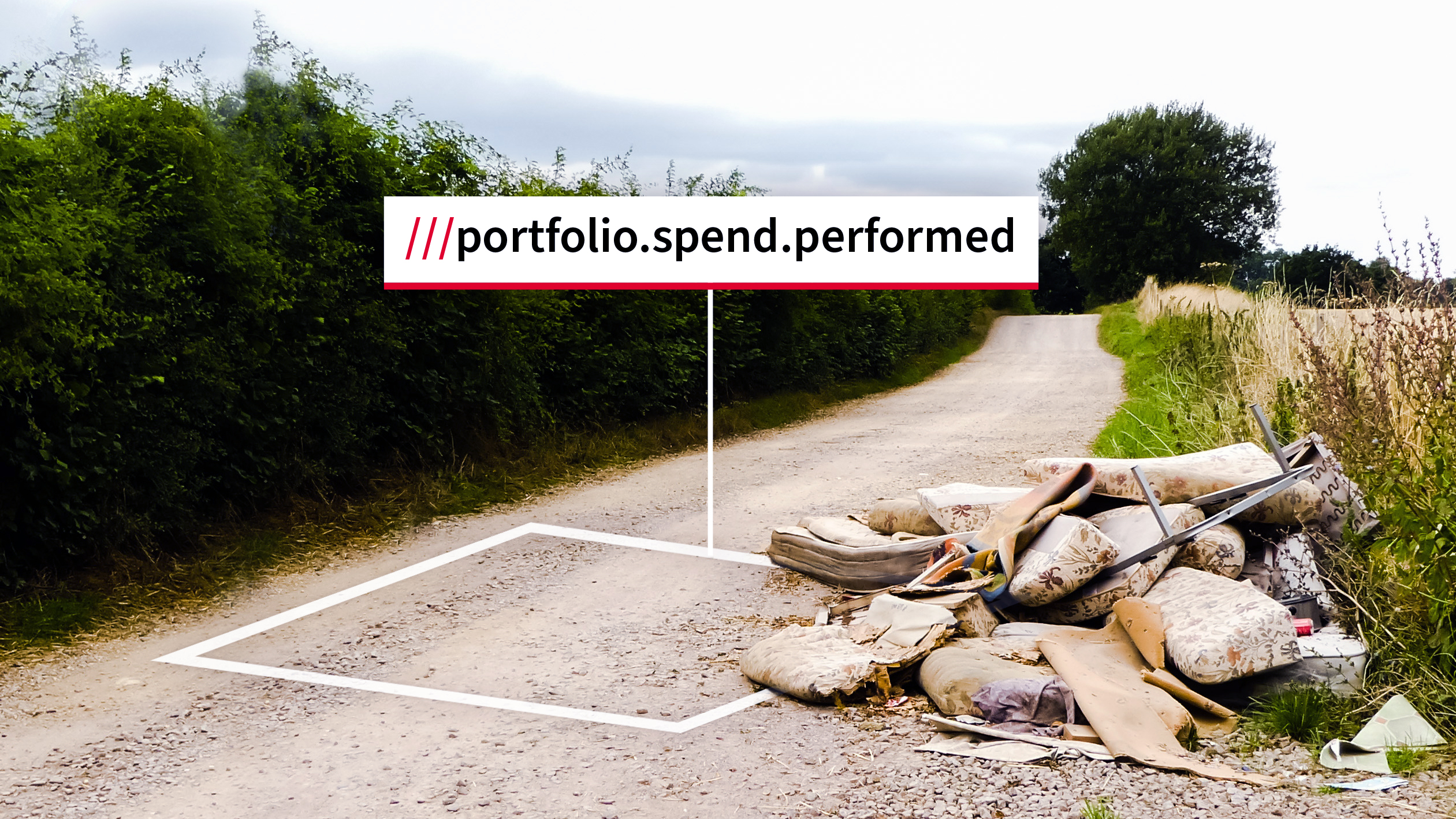
Tackling illegal waste dumping is made significantly easier with precise location data, improving response times and enforcement.
- East Northamptonshire Council’s Leader, Cllr Steven North , noted: “Our waste team works tirelessly to ensure that fly-tipping is dealt with swiftly and quickly across the district, but can’t do so without the help of residents. By encouraging everyone to start using the what3words app, we hope we’ll be able to locate and deal with fly-tipping much quicker “.[ 6]
- Neath Port Talbot Council recognises that what3words “ could save considerable time and effort pinpointing the site of fly-tipping or some other incident “.[ 13]
- Both Epping Forest (City of London Corporation) and North Yorkshire Council actively encourage the use of what3words for reporting fly-tips, emphasizing the need for accurate descriptions and locations to enable quick response and investigation.[ 16, 17]
Emergency response & public safety
what3words addresses are accepted by over 85% of UK emergency services – including police, fire, and ambulance – helping them find and respond to incidents faster and more efficiently.[ 9] This broad acceptance underscores what3words’ critical role in saving precious time and resources during emergencies.
- The Warwickshire Road Safety Partnership has leveraged what3words to decrease the time it takes for emergency services to find callers’ locations. Cllr Wallace Redford, Portfolio Holder for Transport and Planning , highlighted the life-saving potential: “When responding to incidents, the emergency services can sometimes spend critical time and resources working to locate people in need of help. While this does not generally stop help arriving, for some patients, what3words could be the difference between life and death” .[ 6]
- Worcestershire County Council utilises what3words for “Emergency Planning and Highway Emergency situations to accurately identify and communicate incident locations with other council teams and external agencies,” which is crucial when time is of the essence.[ 6] This ensures all relevant parties have the exact incident location, streamlining coordinated responses.
- The Vale of Glamorgan Council’s partnership with South Wales Police for coastal path signage [ 10] is a prime example of proactive public safety. PCSO Rhiannon Cummings said: “ Being able to provide the what3words will allow people who need emergency assistance to be located quicker, especially in darkness hours when searching these areas can be dangerous” .[ 10]
- Councils across the UK encourage the use of what3words for emergencies, including Bewdley Town Council [ 19] , Fenland District Council [ 20] , and the Cornwall Community Flood Forum , which highlights its role in saving precious time and resources.[ 21] These endorsements across various levels of local government and emergency services solidify what3words’ position as a vital tool for public safety.
Asset management & infrastructure
Councils manage vast arrays of public assets, from streetlights and drainage systems to parks and public furniture. what3words provides a precise way to catalogue, inspect, and maintain these, significantly improving operational efficiency.
- what3words enables infrastructure organisations, including local authorities, to “record and manage internal assets, making it easy for staff and contractors to find and share any precise location”. [ 8]
- The technology’s seamless integration with widely used GIS platforms like Esri ArcGIS and QGIS is key for efficient operations and spatial data management, allowing councils to overlay precise location data onto their existing mapping systems.[ 5]
- Software like OTISS , used by some parish councils for tree management, integrates what3words for pinpointing tree locations for surveys and maintenance.[ 22] This specific application illustrates how what3words can be used for niche municipal needs.
Planning & coordination
Precise location information is crucial for effective municipal planning, from managing large public events to enforcing planning regulations. what3words enhances the ability of councils to coordinate activities and ensure public safety.
- Bradford Council’s event planning guidance explicitly states that “Event locations are easier to find with what3words addresses,” covering public entrances, first aid points, and key attractions.[ 23] This enhances safety and visitor experience at events by ensuring clear navigation for attendees and rapid deployment for emergency services.
- South Staffordshire Council’s planning enforcement request form allows citizens to provide a what3words reference to identify the exact location of an issue, streamlining the reporting and investigation process for planning and building concerns.[ 25] This reduces ambiguity and speeds up the resolution of planning breaches or environmental issues.
- The Granicus govService Platform , widely used by the public sector, supports what3words for reporting issues like damaged trees or antisocial behaviour, enabling locations to be “passed between teams and different agencies quickly and easily”.[ 26] This capability is critical for inter-agency collaboration and efficient cross-departmental coordination, ensuring that relevant teams can access precise location information without delay.
Conclusion
The rapid adoption of what3words by UK councils is a clear indicator of its proven value and growing necessity in public service delivery. From enhancing critical emergency response to streamlining everyday municipal operations and promoting citizen engagement, what3words is transforming how local authorities interact with their physical environments and the communities they serve. The ongoing integration with key public sector platforms and the consistent positive feedback from council representatives underscore a future where precise, human-friendly location communication becomes a standard, not an exception.
Works cited
[1] what3words Gains Significant Traction Across the US, Revolutionizing Location Communication https://what3words.com/business/what3words-gains-significant-traction-across-the-us-revolutionizing-location-communication
[2] Revolutionising Location Accuracy for Council Amenities https://parishcouncilwebsites.org.uk/revolutionising-location-accuracy-for-council-amenities/
[3] Know your location – what3words – Kenmore & District Community Council https://www.kenmore-and-district-cc.org.uk/know-your-location-what3words
[4] What3words will help residents report issues and identify locations with ease – South Staffordshire Council https://www.sstaffs.gov.uk/news/2025/what3words-will-help-residents-report-issues-and-identify-locations-ease
[5] About us – What3Words https://what3words.com/about
[6] Over 100 councils are using what3words in the UK | what3words https://what3words.com/news/blog/over-100-councils-are-using-what3words-in-the-uk
[6] what3words Case Study AWS https://aws.amazon.com/solutions/case-studies/what3words-case-study/
[7] Easily identify the precise location of assets and incidents – What3Words https://what3words.com/business/infrastructure
[8] How do I use what3words to get help in an emergency? (UK only) https://support.what3words.com/en/articles/1524098
[9] Vale of Glamorgan coastline – what3words signage initiative – South Wales Police https://www.south-wales.police.uk/news/south-wales/news/2024/january/vale-of-glamorgan-coastline—what3words-signage-initiative-/
[10] Fixed Assets Register 2024-25 – Newton and Noss Parish Council https://www.newtonandnoss-pc.gov.uk/wp-content/uploads/sites/105/2025/04/Asset-Register-2024-25-for-website.pdf
[11] Cumbria County Council https://cumbria.gov.uk/eLibrary/Content/Internet/544/3887/4428613654.pdf
[12] Report incident locations efficiently – What3Words https://what3words.com/report-incident-locations-efficiently
[13] Report or track a problem on a road or pavement – Kent County Council https://www.kent.gov.uk/roads-and-travel/report-or-track-a-problem-on-the-road-or-pavement
[14] Meet some of the inspiring UK companies innovating with what3words https://what3words.com/uk-companies-innovating-with-what3words
[15] Fighting fly-tipping – City of London https://www.cityoflondon.gov.uk/things-to-do/green-spaces/epping-forest/how-we-manage-epping-forest/fighting-fly-tipping
[16] Fly-tipping | North Yorkshire Council https://www.northyorks.gov.uk/environment-and-neighbourhoods/fly-tipping
[17] What is what3words? – Bewdley Town Council https://bewdleytowncouncil.gov.uk/news/what-is-what3words
[18] Useful websites/social media sites – Fenland District Council https://www.fenland.gov.uk/article/16797/Useful-websites-social-media-sites
[19] Speaker Presentation Resources – Cornwall Community Flood Forum https://www.cornwallcommunityfloodforum.org.uk/2022conference/speaker-presentation-resources/
[20] GIS News – What3Words https://what3words.com/news/gis
[21] Have you heard about ‘What 3 Words’? – OTISS – Support https://www.otiss.co.uk/support/help/maps-drawings/what-3-words/
[22] General Guidance – event planning – Bradford Council https://www.bradford.gov.uk/emergencies/emergency-management/general-guidance-event-planning/
[23] St Helena Emergency Services Rolls Out ‘what3words’ Location Technology https://www.sainthelena.gov.sh/2025/press-releases/st-helena-emergency-services-rolls-out-what3words-location-technology/
[24] Report a planning or building issue – Sign in https://southstaffs.portal.uk.empro.verintcloudservices.com/site/southstaffs/request/planning_enforcement
[25] Granicus simplifies location finding for the public sector with what3words https://granicus.com/uk/press-release/granicus-simplifies-location-finding-for-the-public-sector-with-what3words/
[26] what3words LinkedIn https://www.linkedin.com/posts/what3words_reportingincidents-efficient-activity-7343960981313568768-x7tS?utm_source=social_share_send&utm_medium=member_desktop_web&rcm=ACoAACwfqOwBPY7zZmVe9dliQPTv64grpBveSE4